Introduction
The University of Connecticut Historic District on its main campus in Storrs was designated by the National Register of Historic Places in 1989. The District encompasses the original campus core and a number of adjacent residential buildings. In total, fifty-eight (58) buildings and one (1) site comprised the District as either contributing or noncontributing resources when it was nominated in 1988. Three (3) of the buildings and the sole site were not owned by the University at that time, and that remains true today.
The nomination described the physical appearance of those fifty-nine (59) properties, their relationship to each other and to the campus’ historical context, the landscapes between buildings, and the architectural significance of forty-seven (47) buildings identified as contributing resources. Twelve (12) of those contributing resources – the School of Nursing, the Office of Facilities, the Landscaping Barn/Motor Pool, and nine (9) cottages in an area of campus once known as Faculty Row – are no longer present. One (1) noncontributing resource, the Baker Cottage, is also no longer present today. Additionally, the Fire Department/Power Plant and the Heating Plant have been substantially altered and incorporated into a larger Central Utility Plant, and five (5) new buildings have been constructed within the District since its designation, including the Cogeneration Plant, Engineering & Science Building, Chemistry Building, Advanced Biotechnology Laboratory, and an addition to Storrs Hall.
Of note, Farwell Barn, also known as Jacobson Barn, and a portion of the University’s Depot Campus in Storrs-Mansfield once known as the Mansfield Training School, each have separate and distinct historic designation on the National Register. There is no building within the University of Connecticut Historic District with its own designation.
Evaluating the District
The University’s Campus Master Plan 2015-2035 (May 2015) included a high-level summary of the Historic District and reimagined its name as the ‘Heritage District’ for future planning purposes. Appendix E of the Master Plan (Historic Preservation and Adaptive Reuse Plan) included diagrams of building locations, summaries of facility condition assessments, and recommendations on what to retain, renovate, or replace. It was intended to assist the University with mitigation opportunities as well as potential revisions to the District’s boundary or alterations to its contributing resources.
In order to realize the Master Plan’s vision, many contributing resources would need to be documented, renovated, or even replaced, however the University did not have a clear process or consistent platform for their evaluation. As such in 2016, a supplement to the Master Plan was commissioned to 1) better understand the District and how its heritage may be preserved, 2) establish a process to guide decision-making when contributing resources require rehabilitation, restoration, reconstruction, or replacement, and 3) recognize those decisions also relate to advancing the University’s academic mission and other institutional goals.
This supplementary document, University of Connecticut Historic District: Evaluation and Process, as revised in January 2017 and available here, enhances and updates the Master Plan with additional guidelines and strategies for buildings and landscapes with historic importance. While its focus is resources within the District, the process and evaluation method may also apply to other University properties in the future.
Initial Steps for Evaluation
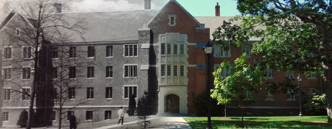
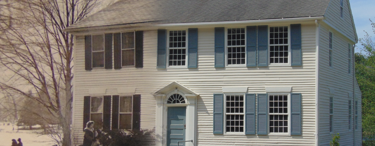
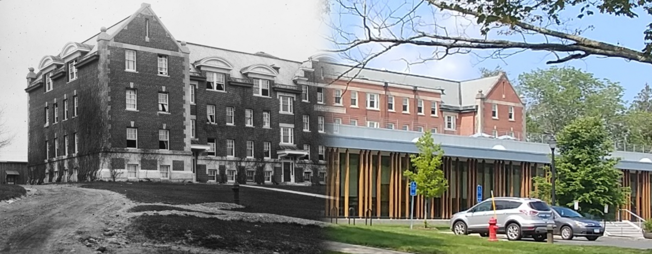
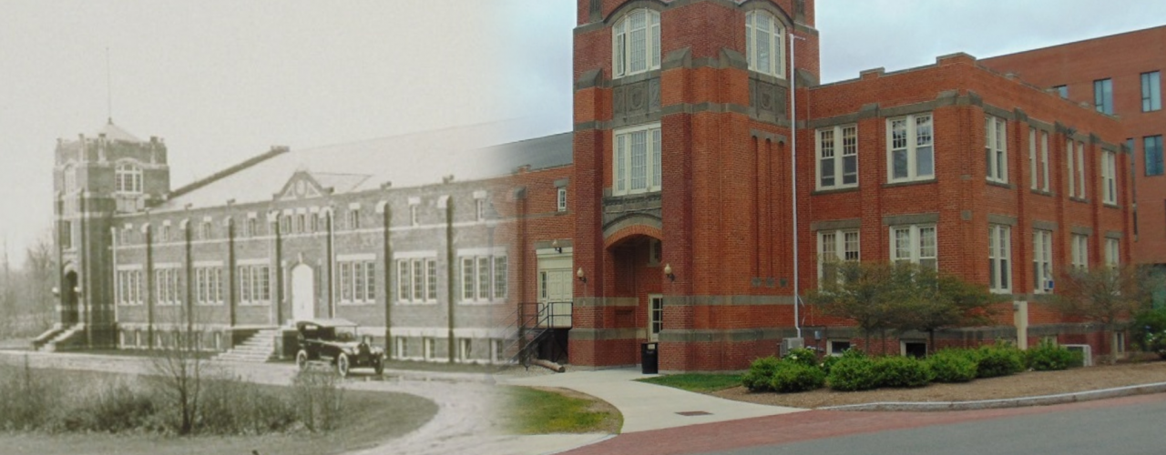
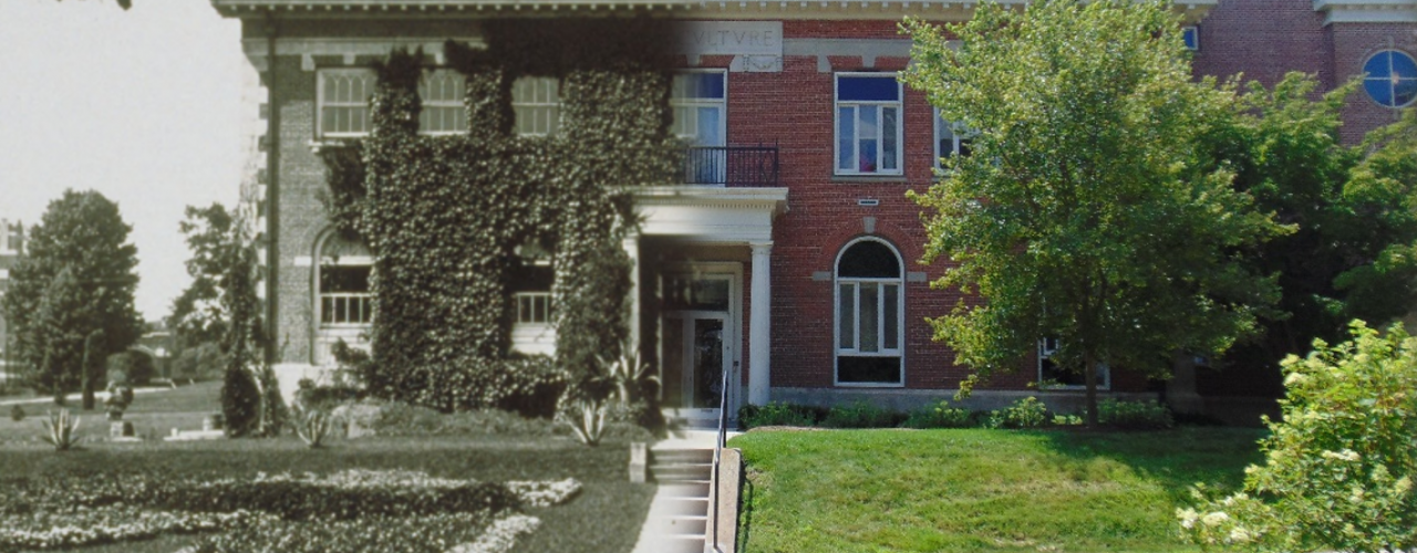
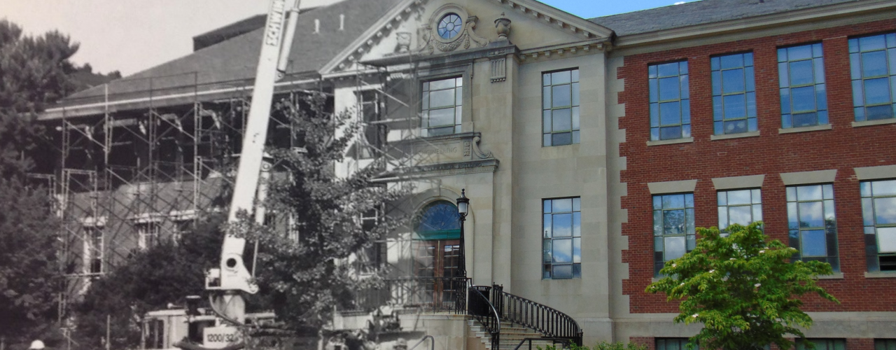
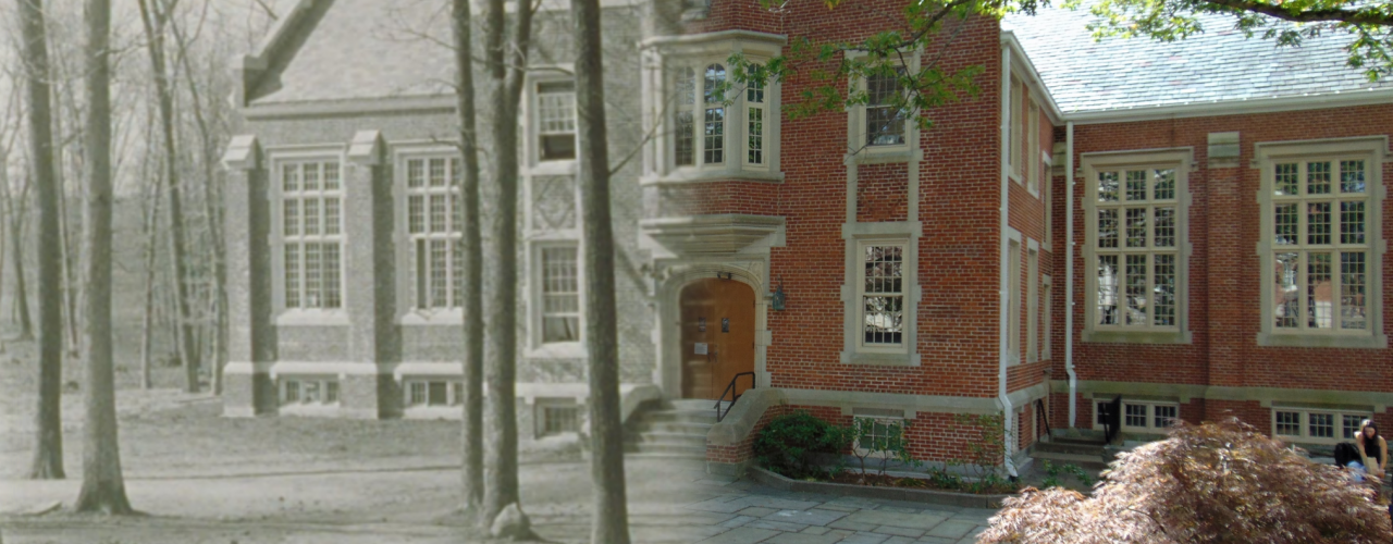
Upon completion and acceptance of the supplement, two students pursuing architectural and landscape architectural careers began assisting members of the Office of University Planning, Design and Construction with an inventory and analysis of the District during the summer of 2017. Their first step was to identify research and sources for existing information on the contributing resources within the District. This included review of document archives, facility assessment reports, original floor plans and drawings, and hundreds of photographs.
After initial data gathering was complete, the students visited each resource to photograph their exteriors, document observations on historic features and architectural merit, and note potential issues requiring repair or maintenance. They also recorded their thoughts and impressions regarding the landscape surrounding those resources.
Next, the students began to consolidate information from their site inventories and analyses into a series of reports for each resource. They painstakingly organized countless photos into a variety of common categories and keyed each vantage point on a location plan. Each report was then reviewed and refined to include graphical comparisons of original floor plans and elevations to those representing present day conditions.
Upon completing most of their work on exterior conditions by the end of summer, the students began the fall semester of 2017 documenting interior conditions of each contributing resource. Like the approach for exterior conditions, their photographs and observations were primarily focused on issues of historic features, architectural merit and potential repair or maintenance. They quickly concluded that many interiors were renovated or modernized over the years, and bared little resemblance to their original interiors. Therefore, their inventory emphasized those features that appeared to be unaltered or preserved.
In addition to the floor plan and elevation comparisons, and the numerous captioned photographic inventories and analyses, each report also contains an overview of each respective resource and a map identifying their location within the District. As draft reports were finalized between November 2017 and January 2018, each report was reviewed a final time for accuracy, quality and consistency.
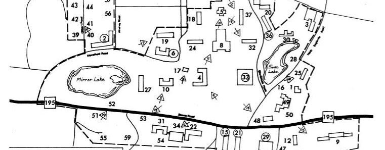
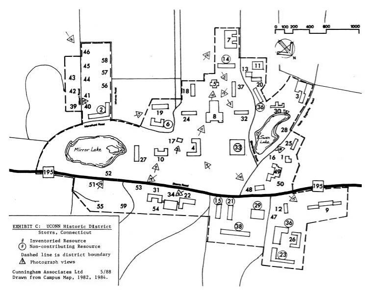 Original District Map
Existing Contributing Resources
Existing NonContributing Resources
|